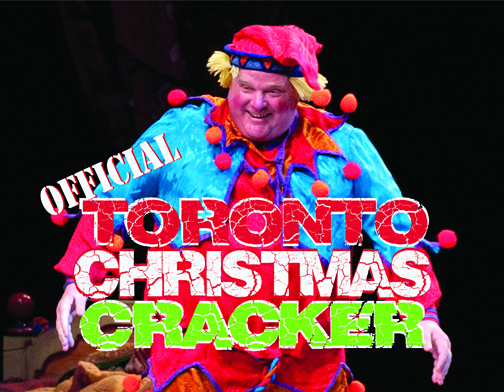
How could we not participate in the celebration that is Rob Ford? Click the pic to order it now!
CCTXM015 Not only does Toronto Mayor Rob Ford smoke crack, he even once made a cameo appearance in the National Ballet of Canada’s “The Nutcracker” on December 10, 2011. Ford appeared as a bellicose Cannon Doll although some reports suggest that he may have been on one of his “drunken stupors” and mistook the cannon as a giant crack-pipe. Toronto, Ontario 2011.
From crack to rocks…
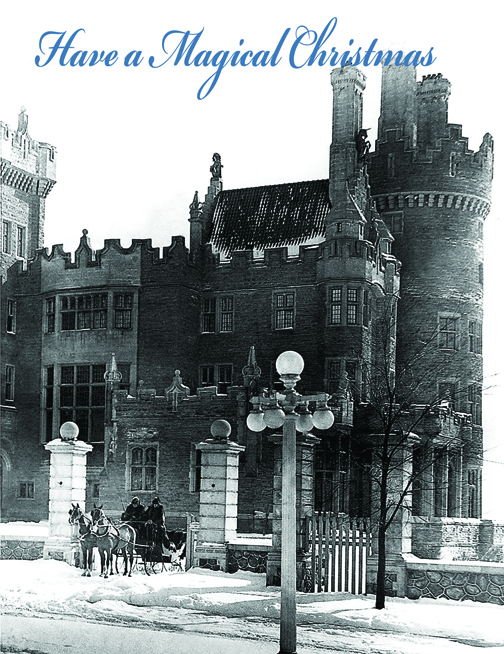
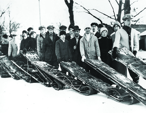
CCTXM014 A Curling party in Swansea, Ontario (now part of Toronto) December 25, 1904.CCTXM017 Sir Henry and Lady Mary Pellatt set out by horse-drawn carriage Toronto, Ontario c1913.CCTXM018 Toboggan enthusiasts line up for the High Park toboggan runs. Toronto, Ontario c1915.
…And let’s keep Santa as far from Mr. Ford as we can.
Thousands of people swarm the streets, walk along beside and sit perched on ledges to watch the floats of the Eaton’s Santa Claus Parade. The parade wound through the streets of Toronto, ending at the Eaton’s James Street entrance where Santa would climb out of his sleigh and up onto the entrance awning to address the crowd. Toronto, Ontario November 15, 1930.
Did you think we’d forgotten about doing some more great black and white pictures?
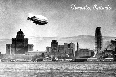
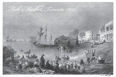
CCT0129 Dirigible flying over Toronto 1930CCT0131 Reproduction of 1834 illustration by William Henry Bartlett, depicting the Toronto shore and fish market. the original coffin building is seen in background, the site of the current Gooderham Flatiron Building at Church and Front and Wellington streets.
CCT0132 Looking east along Queen Street West under the Queen Subway (railway underpass) at Dufferin Street. The Gladstone Hotel, built in 1889, can be seen in the background. Toronto, Ontario April 22, 1915CCT0133 Looking west along Bloor Street West to High Park, Toronto, Ontario 1914.CCT0134 Looking northwest at Bay Street and Queen Street West April 7, 1923.
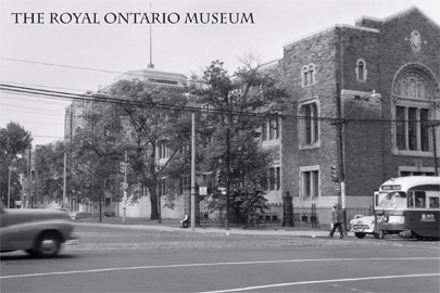
The Royal Ontario Museum (ROM). Looking southwest to Queen’s Park and Bloor Street West from Avenue Road Toronto, Ontario 1957.“The Northumberland” crossing Toronto Harbour with skyline in background c1930.
Hey everyone, here’s the latest from the Canadian Culture Thing postcard line…
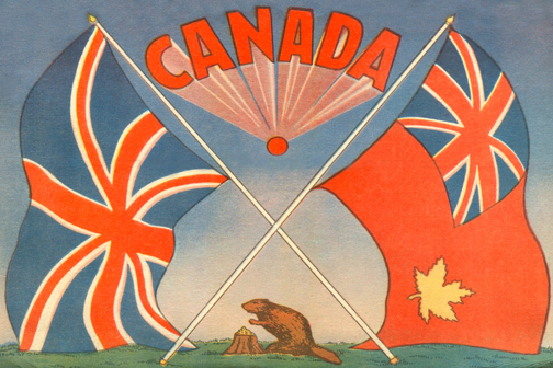
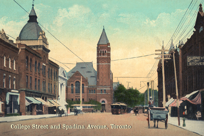
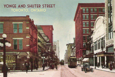
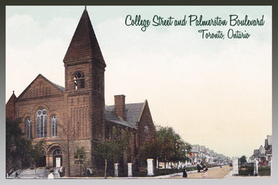
CCT0115 – This photo was provided by the possessor of the alleged “Crack Video” that shows Toronto Mayor Rob Ford smoking crack in early 2013. Other than three corroborating reported viewings by twoToronto Star reporters and one from Gawker, the video has not yet surfaced. Though this photo is not taken from the video, it was allegedly taken during another “Ford crack run” and has become the symbolic image of the videoCCT0116 – Cover of “Sport Fishing in British Columbia” booklet 1953. / Couverture de livret “pêche de sport en B.C.” 1953.CCT0117 – Concert poster for the Beatles at Maple Leaf Gardens on August 17, 1966. Having performed in Canada in 1964 and 1965, this would be their last concert in Canada. / Concertez l’affiche pour le Beatles aux jardins de feuille d’érable le 17 août 1966. L’exécution au Canada en 1964 et 1965, ceci serait leur dernier concert au Canada.CCT0118 – Former Prime Minister Jean Chrétien moves an anti-poverty protester out of his way in Hull, Quebec on Feb. 15, 1996. The Prime Minister’s chokehold became known as the Shawinigan Handshake after his home town. / L’ancien premier ministre Jean Chrétien déplace un protestataire combattant la pauvreté hors de sa voie dans la coque, Québec le 15 février 1996. Le chokehold du premier ministre est devenu notoire comme prise de contact de Shawinigan après sa ville natale.CCT0119 – Northwest Mounties #2 comic book cover 1948.CCT0120 – Animated Map of Canada c1953.CCT0121 – The official Canadian Ensign Flag with the British Union Jack flag…and a beaver. c1934. / L’indicateur Canadien officiel d’insigne avec l’indicateur britannique d’Union Jack… et un castor. c1934.Cover of Girls’ Friend Library Featuring The Shamed Wife, a compelling Novel of Canadian Life and Love. No. 387 May 4, 1933.CCT0123 – Cover of Dominion of Canada Animated Atlas c1920. Newfoundland would not join Canada until 1949. / La couverture du dominion du Canada a animé l’atlas c1920. Newfoundland ne joindrait pas le Canada jusqu’en 1949.CCT0124 – Looking east along College Street toward Spadina Avenue, Toronto, Ontario c1908. / Regard est le long de la rue d’université vers l’avenue de Spadina Toronto, Ontario c1908.CCT0125 – Looking south down Yonge Street toward Shuter Street Toronto, Ontario c1915. / Regard de la rue de Yonge de sud vers le bas vers la rue Toronto de Shuter, Ontario c1915.CCT0126 – Looking east along Queen Street West toward at Macdonell Street Toronto, Ontario c1900. / Regarder est le long de la rue de la Reine occidentale vers la rue de Macdonell Toronto,Ontario c1900.Looking northwest toward College Street Baptist Church (built 1889) at College Street and Palmerston Boulevard (formerly Muter Street) Toronto, Ontario c1909. / Regarder du nord-ouest vers l’église baptiste de rue College (construite 1889) la rue College et le boulevard de Palmerston (autrefois rue de Muter) Toronto,Ontario c1909.Large Letter Ottawa Postcard c1930
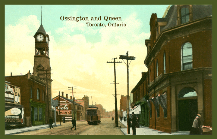
Here’s a relatively dull image of the foot of Ossington Avenue at Queen Street West. You might recognize that some of the buildings still remain (even in part). Though it is now becoming the gateway to a great dining strip, it certainly pales in comparison to the charm it once had.
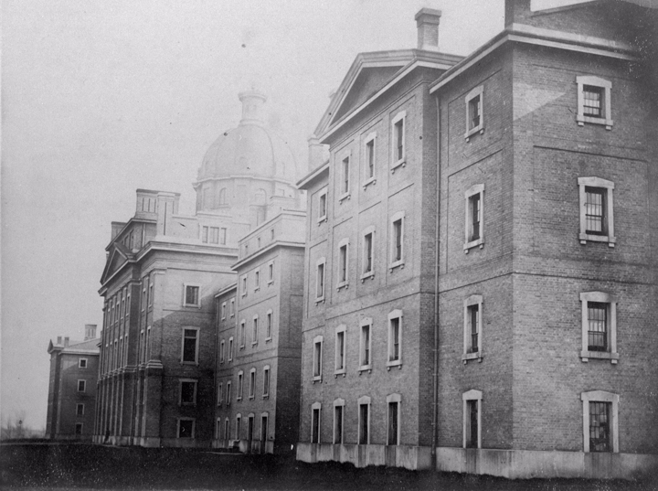
Once called Dundas Road, Ossington served the community of workers from the many local factories as well as the Provincial Lunatic Asylum. Today, sounding more like a night-club than a hospital, the Provincial Lunatic Asylum which once sat on the south side of Queen Street West is now called the Centre for Addiction and Mental Health (CAMH). While the original parameter wall still stands on Shaw St. and along the rear wall as well as some of the grounds buildings, there is nothing left of the original building. Though the new buildings of CAMH are utilitarian and dull compares to the once-majestic (on somewhat ominous) Provincial Lunatic, what we’ve lost in it’s beauty of architecture, we’ve gained in social understanding and tolerance.
This view is from Queen circa 1909 showing the original clock tower of the original Dundas Road fire hall. Seen also is a Toronto Railway Company streetcar travelling south. In 1921 the TRC joined with the Toronto Civic Railways to become the Toronto Transit Commission, or TTC.
At this time Ossington Avenue was called Dundas Road. When the Toronto city limits only reached as far west as Bathurst Street, Dundas Street West ended there at it’s far western end. Arthur street was the continuation west and began a short distance north from Dundas. Today, Dundas curves north east of Bathurst to connect with the former Arthur Street.
Note the Painted Coca Cola wall. This photo was taken within 15 years of the very first wall painted with a Coca Cola advertisement.
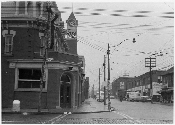
Queen and Ossington looking north October 23, 1958Provincial Lunatic Asylum on south side of Queens street at Ossington (originally Dundas Rd.) 1867.