The Andrew Mercer Reformatory for Women . Canadian Culture Thing presents this look back at a moment in the infancy of Liberty Village in Toronto, Ontario, Canada. Before the cordoned-off micro city of Liberty Village teemed with Condo Behemoths, Liberty Village was home to factories and prisons. Today, Lamport Stadium stands on the former location of the Andrew Mercer Reformatory of Women. Take a look back at the life of a woman in the early 20th century.
Written and Directed by William Hunter Edited and Produced by William Hunter and Chadwick Gendron
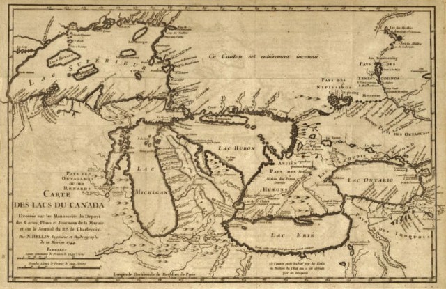
Carte des lacs du Canada – Early Map of the Great Lakes, 1744.
The City of Toronto had been called the Town of York prior to 1834 when it incorporated. But before that the first settlers were probably the Iroquoian-speaking Wendat people, who the Europeans called the Huron. These people settled on the north shore of Lake Ontario where they lived in longhouses. Wendat means peninsula-island dwellers this is because of the shape of the land on the north shore. They believed that the world was on an island resting on the back of a turtle.
Map from the attack of York 1813.
The natives used variations of the name Toronto for different areas in the vicinity, as well as for fishing tools that they used. The French then used it again when they named Fort Toronto at the foot of the Humber River. So, when the Town of York incorporated in 1834 it changed its name to Toronto. The legislative council changed York to Toronto because it was a more unique name and because of its native roots.
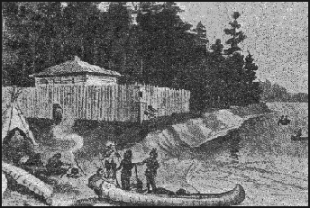
Drawing of Fort Toronto (uncredited)
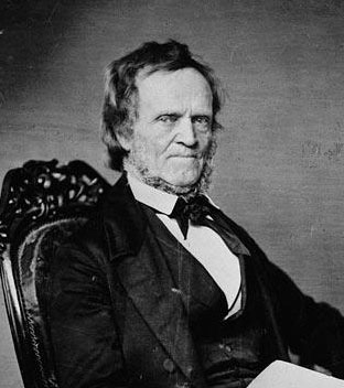
Three weeks after Toronto incorporated, William Lyon Mackenzie was elected its first mayor. William Lyon Mackenzie was born in Scotland on March 12, 1795 and came to Canada in 1820. He was a reformer and the editor of the Colonial Advocate newspaper. He was only mayor for one year.
William Lyon Mackenzie (1834).
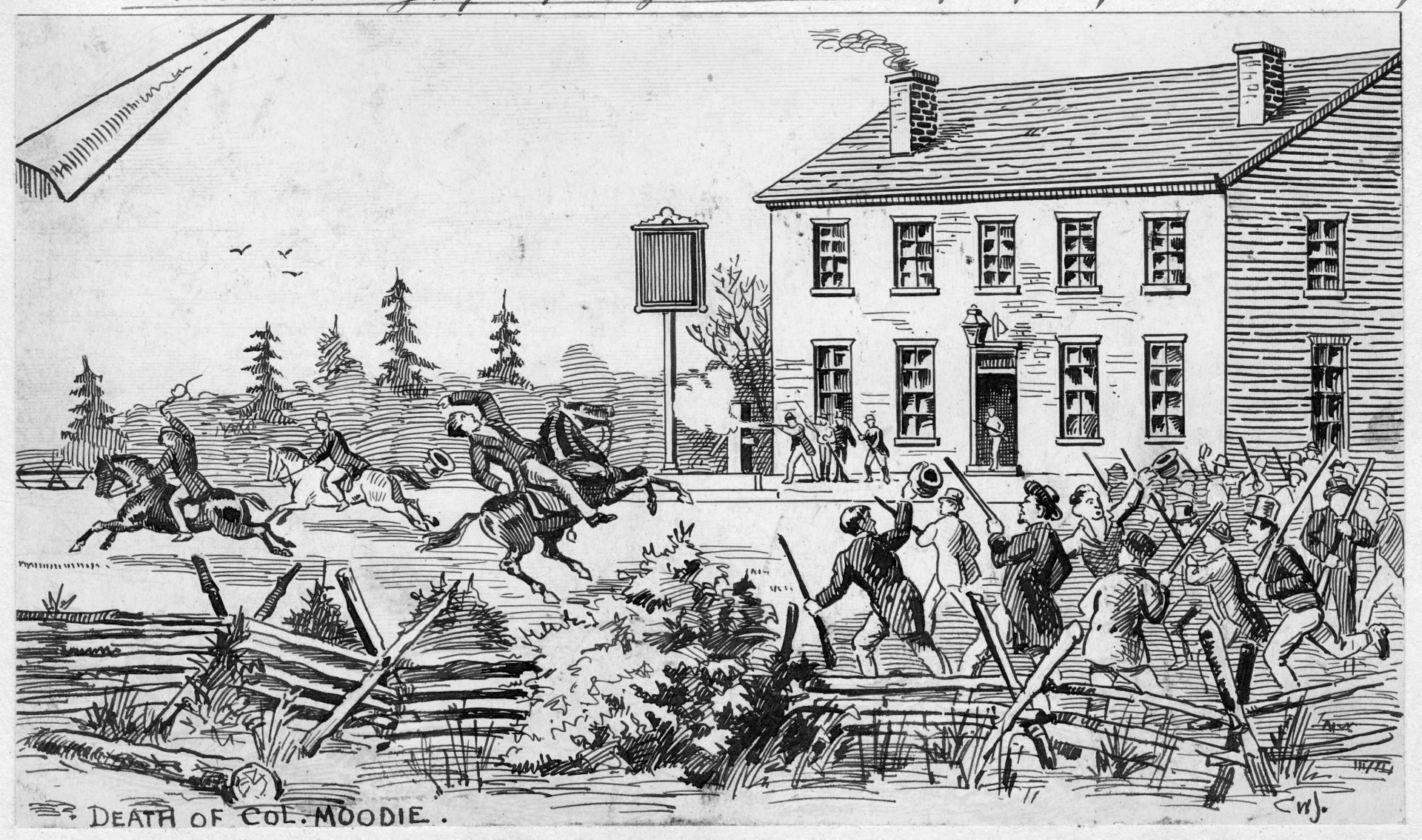
In 1837, Mackenzie led a rebellion in Upper Canada. The one and only battle took place at Montgomery’s Tavern. Although the battle ultimately lasted only a half an hour, and they lost, because of the rebellion the British Government realized the problems in Canada and made changes.
Drawing from the Upper Canada Rebellion showing the battle at Montgomery’s Tavern
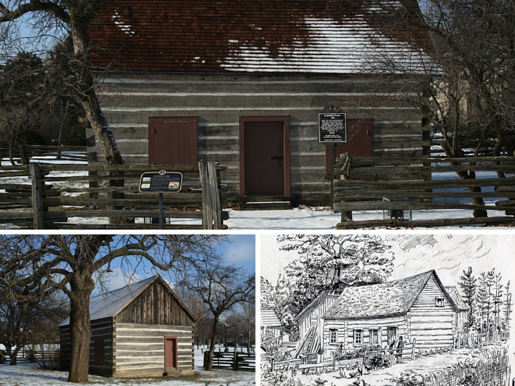
Remaining from the old Town of York, the oldest building in Toronto is John Scadding’s cabin, which was built in 1794. It was located near the Don Valley but was later relocated, as a historical landmark to the Canadian National Exhibition grounds in 1879 by the York Pioneers Historical Society.
John Scadding’s Cabin, past and present
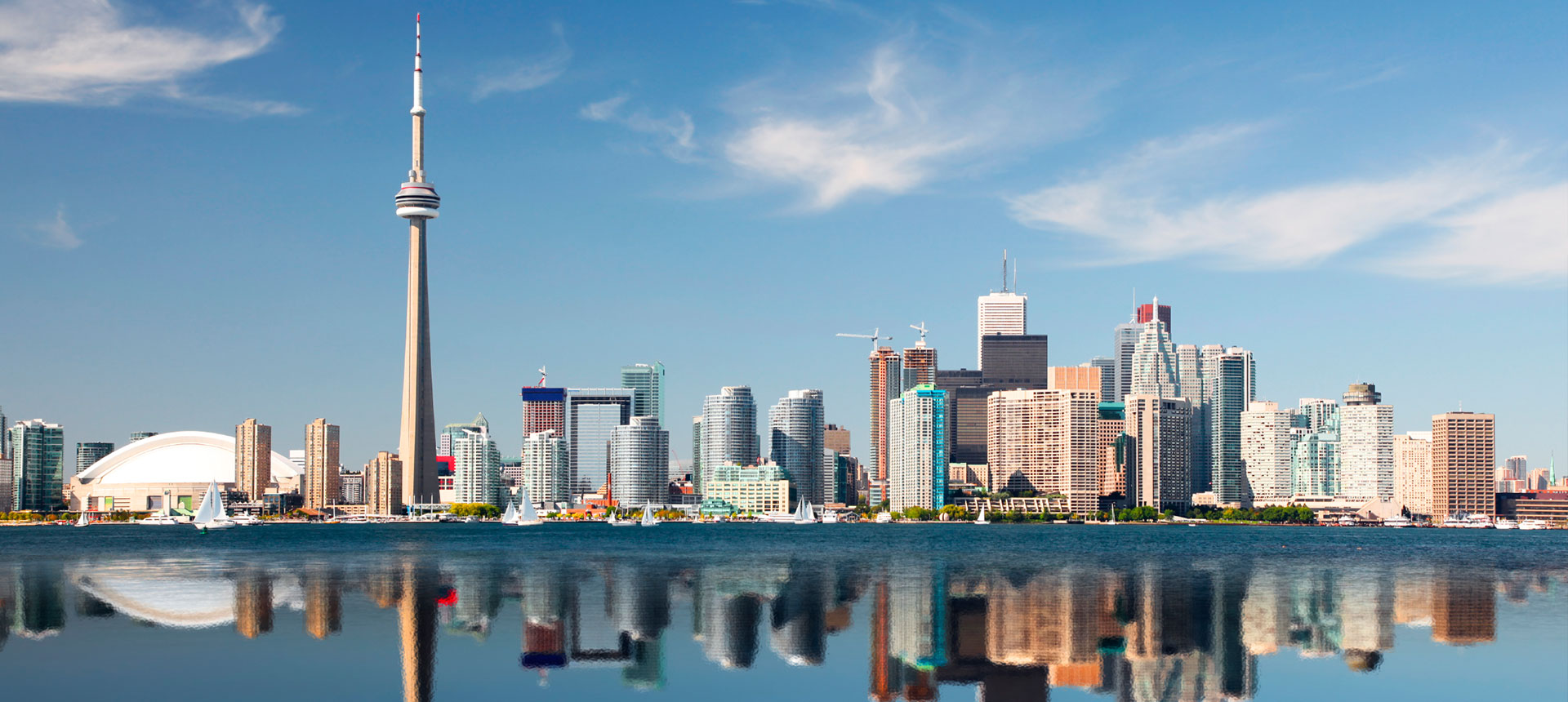
In 1834, the population of the City of Toronto was only 9,254. The boundaries of the city were between Lake Ontario on the South, Parliament street on the East , Bathurst street on the West, and 365 metres North of Lot street (now known as Queen street). The city was only 3.6 square kilometres. Today the population is a whopping 2.6 million people and the city covers 630 square kilometres.
City of Toronto today
by Kate Gendron (age 10)
Givin’s-Shaw Public School
Ms. Stockton’s Grade 4 Class Project
2017
University Avenue, looking north from Queen Street West. At the time of this picture, University Avenue was called College Avenue and was the picturesque entrance to U of T (1849) and it’s former namesake King’s College (1827). the Ontario Legislative Building at Queen’s Park (1893) would begin construction in 1886. The name would change in the first years of the 20th century. Toronto, Ontario 1880.
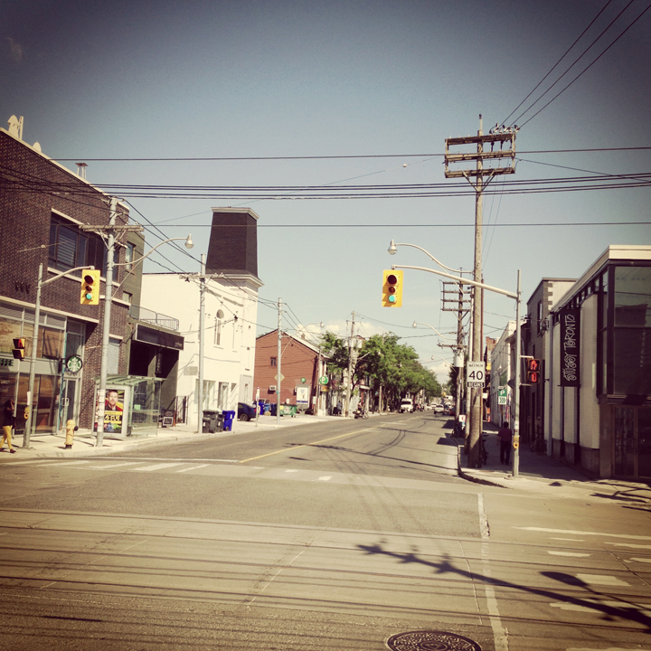
Here’s a hint. You’re looking north up one of Toronto’s main arteries…
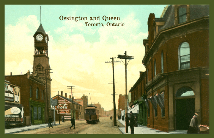
Here’s a relatively dull image of the foot of Ossington Avenue at Queen Street West. You might recognize that some of the buildings still remain (even in part). Though it is now becoming the gateway to a great dining strip, it certainly pales in comparison to the charm it once had.
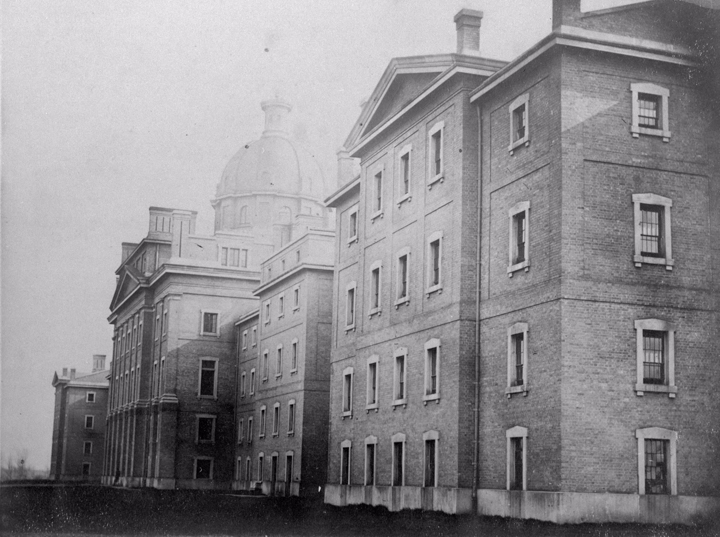
Once called Dundas Road, Ossington served the community of workers from the many local factories as well as the Provincial Lunatic Asylum. Today, sounding more like a night-club than a hospital, the Provincial Lunatic Asylum which once sat on the south side of Queen Street West is now called the Centre for Addiction and Mental Health (CAMH). While the original parameter wall still stands on Shaw St. and along the rear wall as well as some of the grounds buildings, there is nothing left of the original building. Though the new buildings of CAMH are utilitarian and dull compares to the once-majestic (on somewhat ominous) Provincial Lunatic, what we’ve lost in it’s beauty of architecture, we’ve gained in social understanding and tolerance.
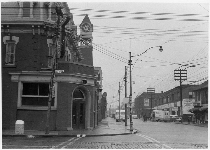
This view is from Queen circa 1909 showing the original clock tower of the original Dundas Road fire hall. Seen also is a Toronto Railway Company streetcar travelling south. In 1921 the TRC joined with the Toronto Civic Railways to become the Toronto Transit Commission, or TTC.
At this time Ossington Avenue was called Dundas Road. When the Toronto city limits only reached as far west as Bathurst Street, Dundas Street West ended there at it’s far western end. Arthur street was the continuation west and began a short distance north from Dundas. Today, Dundas curves north east of Bathurst to connect with the former Arthur Street.
Note the Painted Coca Cola wall. This photo was taken within 15 years of the very first wall painted with a Coca Cola advertisement.
Queen and Ossington looking north October 23, 1958
Provincial Lunatic Asylum on south side of Queens street at Ossington (originally Dundas Rd.) 1867.
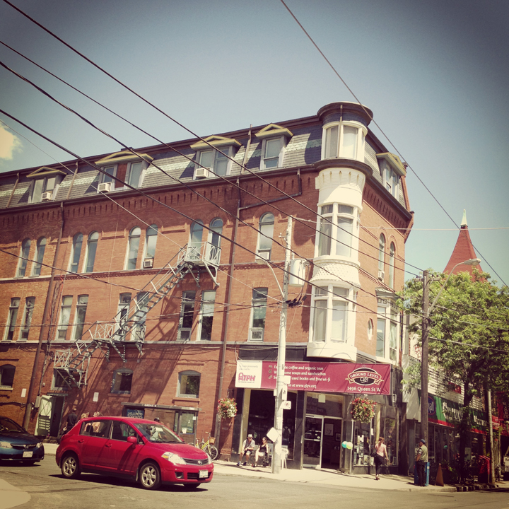
Here’s a photo I took this week of a great building on the north east corner of Queen Street West at Macdonell Avenue in Parkdale.
And here is the same corner from circa 1900. This photograph of the intersection of Queen Street West and Macdonell shows the above 1880’s building with it’s dome still intact.